
Map Springfield ZIP Code Coverage
Four USPS postal labels serve the Springfield area: 22150, 22151, 22152, and 22153. This ZIP code directory begins with those labels, then keeps their limits visible. A postal-area name is not the boundary of the Springfield census-designated place, a magisterial district, or a neighborhood. Fairfax County sources supply useful neighborhood anchors for the first three labels. For 22153, the official material confirms the postal label and demographic context but does not provide a complete neighborhood-by-ZIP list. That gap should stay a gap rather than become an invented boundary.
| Postal ZIP | County neighborhood anchors | Post office label | Research note |
|---|---|---|---|
| 22150 | Brookfield, Franconia, Lake Accotink, Loisdale, Monticello Woods, Springfield Forest, and Trailside. | Springfield, VA 22150 | Includes Springfield and related community labels, not a CDP boundary. |
| 22151 | Deerlick, Edsall, Flag Run, Kings Park, Leewood, North Springfield, and Royal Ridge. | Springfield, VA 22151 | North Springfield and Kings Park are community labels inside one postal service area. |
| 22152 | Cardinal Forest, Orange Hunt Estates, West Springfield, West Springfield Village, and other county groupings. | Springfield, VA 22152 | Postal and community labels overlap, while service and district boundaries differ. |
| 22153 | No complete official neighborhood anchor list located in the cited county material. | Springfield, VA 22153 | Use an exact address and county data rather than filling the gap with an assumed boundary. |
The U.S. Postal Service lists all four labels as Springfield, Virginia. That makes the postal code a good way to organize a search, but a result still needs county address and parcel confirmation.
Read Springfield 22150 ZIP Code
County neighborhood and park groupings place Brookfield, Byron Avenue, Franconia, Hooes, Lake Accotink, Lee High, Loisdale, Lynbrook, Monticello Woods, Springfield Forest, Springvale, and Trailside under 22150. These names are helpful alternate search terms when an address is described by a subdivision or community rather than only by a postal label. They are not separate municipal governments, and they do not turn 22150 into the legal perimeter of Springfield.
Fairfax County's 2022 demographic report lists 28,386 people, 9,287 units, and 9,123 households for the 22150 ZIP/ZCTA-style geography. Those totals describe a postal-area demographic unit, not a current directory of Springfield people or a municipal population count.
Compare Springfield 22151 ZIP Code
The 22151 label includes anchors such as Edsall, Kings Park, North Springfield, and Royal Ridge. That combination shows why a ZIP code directory needs more than one place name. A historical address may use North Springfield or a neighborhood name, while USPS mailing information uses Springfield. Search both forms when checking an older directory, county address file, or map, then compare the number, street suffix, and parcel identifiers.
For 2022, Fairfax County reports 17,539 people, 5,820 units, and 5,741 households in the 22151 demographic geography. The county's 2010 and 2022 totals are useful context only. They cannot identify who is associated with an individual address. Note: Keep North Springfield and Kings Park as alternate locality terms when checking a period record.
Locate Springfield 22152 ZIP Code
Cardinal Forest, Carrleigh, Fairfax Park, Greentree Village, Hidden Pond, Hunter Village, Orange Hunt Estates, Rolling Forest, Shannon Station, and West Springfield appear in the county grouping for 22152. The West Springfield community name and the Springfield postal label can both be correct in their own settings. County administrative and service boundaries may still use another geography, so do not use the mail label as a substitute for an exact county location.
The official county report places 28,668 people, 10,352 units, and 10,215 households in the 2022 22152 ZIP geography, compared with 30,633 people in 2010. That change is a postal-area measure, not a trend line for a city government or a resident roster.
Treat Springfield 22153 ZIP Code Carefully
USPS uses the Springfield, Virginia label for 22153, and Fairfax County's demographic table records 33,107 people, 10,869 units, and 10,741 households for its 2022 ZIP/ZCTA-style geography. The same table reports 31,527 people in 2010. The research did not locate a complete, official 22153 neighborhood list in the county material. An exact postal address and the county address record are therefore more reliable than a general map label.
This careful treatment is part of using the Springfield ZIP code directory responsibly. A population total describes an area, while an address record describes a site. Neither one establishes a person's current location. Note: Preserve the source year when citing ZIP totals because postal-area reports and address records use different dates and geographies.
Search Springfield ZIP Codes with MAR
First normalize the mail code with the USPS ZIP Lookup. It has three modes: By Address, By City and State, and Cities by ZIP. USPS says the result does not confirm a person, company, or exact identity. Then use the Master Address Repository, or MAR, with ZIP plus a street, number, PIN, subdivision, or current-historical status. MAR can filter the table and map together and export the address results as CSV. It is a stronger county-side address check than a postal label alone.
| USPS mode | Required inputs | What it normalizes |
|---|---|---|
| By Address | Street address, city, and state | The ZIP associated with a supplied mailing address. |
| By City and State | City and state | Postal codes associated with that mailing label. |
| Cities by ZIP | ZIP | Postal city labels connected to the supplied code. |
| MAR Address Search | ZIP with number, street, city, PIN, subdivision, date, or status filters | County address records and the parcel join needed for follow-up. |
The iCare address-search screen has number, unit, street, and suffix fields, rather than a simple ZIP filter.
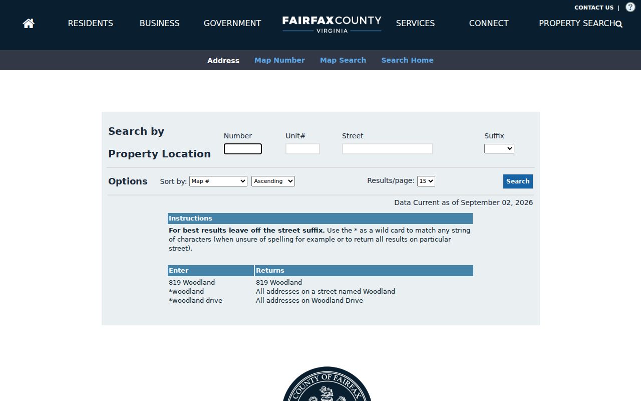
That limitation is useful: confirm the postal code in USPS and MAR, then use iCare by address or PIN to inspect the county parcel record.
Filter Springfield ZIP Code Work
Fairfax PLUS accepts street name, number, unit, city, state, ZIP, and parcel ID in its general search. Building, Enforcement, Environmental Health, Fire, Planning, Site, and Zoning records can be searched by site address or parcel number. A ZIP filter can narrow a large area, while an exact address or parcel ID is what ties a result to one location. Older land-development records may not appear in PLUS, so use the historical county route or the relevant office when the online result is incomplete.
Jade can search by address, PIN, intersection, and subdivision, with ZIP visible in address attributes where available. It also supplies service layers and historical context. Its map lines do not establish a legal boundary or title, and it should be paired with MAR, iCare, and recorded land documents. Note: A ZIP narrows the map search, while an address and parcel ID identify the county record to review.
Find Springfield Records by ZIP
A ZIP-wide search should move from a postal code to exact county address data. It can help organize property, site, planning, or historical-directory research, but it cannot produce a reliable list of people connected with every address. Virginia voter products use locality and election-district filters rather than a simple postal filter, and the Citizen Portal is for an individual's own status information. Use the registrar inspection or state request procedure only within its statutory access rules.
- Use USPS By Address to confirm the mailing ZIP, and preserve the full address as entered.
- Filter MAR by ZIP with street, number, subdivision, or current-historical status. Export only the county address results needed for the question.
- Open matching addresses in iCare by street and number or PIN. Compare situs, mailing line, parcel details, and visible deed references.
- Use Jade for parcel context and PLUS for relevant site or planning records. Keep the map result separate from the legal record.
- When a postal area has been narrowed to a road, use the Springfield street directory for the full address and deed-chain workflow.
For a voter question, derive precinct and district from the exact address. ZIP is not the principal voter-file geography, and a postal code should never be equated with a precinct.
Separate Springfield ZIP Codes from Districts
Springfield has no incorporated municipal city limit to match against its postal labels. It is a Fairfax County community and census-designated place. Its four postal areas overlap names such as Franconia, North Springfield, Kings Park, West Springfield, Springfield Forest, and Monticello Woods. Springfield District and Franconia District are magisterial districts with their own administrative roles, not replacements for the postal geography.
Fairfax Neighborhood and Community Services offers a useful mismatch example. Its contact map combines 22151, 22152, 22153, 22015, part of 22150 west of I-95, and a small portion of 22312 in one service region. That is a service boundary, not a USPS or community boundary. The county's demographic ZIP map is another visual reference, best used with USPS and MAR for an individual address.
- ZIP and ZIP+4
- A ZIP identifies a mail-routing area. ZIP+4 adds a more precise delivery segment; neither one proves municipal jurisdiction.
- PO-box ZIP
- A postal code used for post-office-box delivery. It should not be assumed to describe the physical site of a parcel.
- Unique ZIP
- A ZIP assigned for a single organization or delivery arrangement. No Springfield-specific example was established in the research.
- Carrier route
- A postal delivery grouping. It is a mail-service tool, not a census, county, or neighborhood boundary.
Date Springfield ZIP Code History
No official year-by-year Springfield ZIP realignment chronology was located. The Postal Bulletin confirms the four current Springfield labels, but it does not supply a complete historical boundary map. For an older record, retain the period post-office label and search both that form and the modern Springfield label. Then compare the street number and suffix in MAR's address-history fields, period directories, plats, deeds, and maps.
Historical results may use Springfield Farm, Corbett, Springfield Station, a subdivision, or Fairfax County rather than the current postal wording. A ZIP code directory is strongest when it preserves those older labels as search terms and does not retrofit them into a modern boundary.